Filter by
# Debug Box
/home/libverse/sec.libverse.web.id/lib/SearchEngine/DefaultEngine.php:697 "Search Engine Debug 🔎 🪲"
Engine Type ⚙️: "SLiMS\SearchEngine\DefaultEngine"
SQL ⚙️: array:2 [
  "count" => "select count(distinct b.biblio_id) from biblio as b left join mst_publisher as mp on b.publisher_id=mp.publisher_id left join mst_place as mpl on b.publish_place_id=mpl.place_id left join mst_gmd as mg on b.gmd_id=mg.gmd_id left join biblio_author AS ba ON ba.biblio_id=b.biblio_id left join mst_author AS ma ON ba.author_id=ma.author_id left join biblio_topic AS bt ON bt.biblio_id=b.biblio_id left join mst_topic AS mt ON bt.topic_id=mt.topic_id where b.opac_hide=0 and (b.biblio_id in(select bt.biblio_id from biblio_topic as bt left join mst_topic as mt on bt.topic_id=mt.topic_id where mt.topic like ?))"
  "query" => "select b.biblio_id, b.title, b.image, b.isbn_issn, b.publish_year, b.edition, b.collation, b.series_title, b.call_number, mp.publisher_name as `publisher`, mpl.place_name as `publish_place`, b.labels, b.input_date, mg.gmd_name as `gmd`, GROUP_CONCAT(DISTINCT ma.author_name SEPARATOR ' - ') AS author, GROUP_CONCAT(DISTINCT mt.topic SEPARATOR ', ') AS topic, b.edition, b.collation, b.series_title, b.call_number from biblio as b left join mst_publisher as mp on b.publisher_id=mp.publisher_id left join mst_place as mpl on b.publish_place_id=mpl.place_id left join mst_gmd as mg on b.gmd_id=mg.gmd_id left join biblio_author AS ba ON ba.biblio_id=b.biblio_id left join mst_author AS ma ON ba.author_id=ma.author_id left join biblio_topic AS bt ON bt.biblio_id=b.biblio_id left join mst_topic AS mt ON bt.topic_id=mt.topic_id where b.opac_hide=0 and (b.biblio_id in(select bt.biblio_id from biblio_topic as bt left join mst_topic as mt on bt.topic_id=mt.topic_id where mt.topic like ?)) group by b.biblio_id order by b.last_update desc limit 10 offset 0"
]
Bind Value ⚒️: array:1 [
  0 => "%Sistem informasi geografis%"
]

Pemetaan Hutan dan Sistem Informasi Geografis Dasar
DAFTAR ISI BAB I SISTEM INFORMASI GEOGRAFIS (SIG) BAb II KOMPONEN GIS BAB III GIS DAN MUKA BUMI BAB IV DATA SPASIAL BAB V ALAT UKUR PERPETAAN BAB VI SISTEM PROYEKSI & KOORDINAT BAB VIII APLIKASI Arc GIS BAB IX PENGOLAHAN DATA Arc GIS. BAB X INPUT DATA GPS BAB XI DASAR KARTOGRAFI BAB XII TEKNIK PEMETAAN HUTAN.
- Edition
- -
- ISBN/ISSN
- 9789797968151
- Collation
- 159 hlm; 16 cm x 23 cm
- Series Title
- -
- Call Number
- 634.9 GAL p
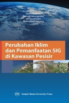
Perubahan Iklim dan Pemanfaatan SIG di Kawasan Pesisir
CHAPTER I MITIGASI PERUBAHAN IKLIM DI WILAYAH PESISIR CHAPTER II PEMANFAATAN TEKNOLOGI PENGINDRAAN JAUH DAN SISTEM INFORMASI GEOGRAFIS UNTUK ANALISIS PERUBAHAN KABUPATEN DEMAK CHAPTER III SISTEM INFORMASI GEOGRAFIS DAN PENGINDRAAN JAUH UNTUK IDENTIFIKASI DAMPAK PERUBAHAN IKLIM CHAPTER IV SISTEM INFORMASI GEOGRAFIS (SIG) DAN PENGINDRAAN JAUH DALAM PENGELOLAAN PESISIR CHAPTER V PERUBAHAN IKLIM SE…
- Edition
- -
- ISBN/ISSN
- 9789794208639
- Collation
- 292 halaman; 15,5 cm x 23 cm
- Series Title
- -
- Call Number
- 551.6 NUR p

GIS (Geographic Information System) untuk Pengelolaan Sumber Daya Hutan
BAB 1 GIS (Geographic Information System): Dari Analog Ke Digital BAB 2 Perangkat Pemetaan Dan Data Spasial BAB 3 Input Data BAB 4 Analisis Permukaan BAB 5 Operasi Dan Analisis Spasial BAB 6 Implementasi Pemodelan Spasial BAB 7 Layout Peta
- Edition
- -
- ISBN/ISSN
- 9786230295072
- Collation
- 152 hlm; 15.5 cm × 23 cm
- Series Title
- -
- Call Number
- 526.0285 WIT g
 Computer Science, Information & General Works
 Philosophy & Psychology
 Religion
 Social Sciences
 Language
 Pure Science
 Applied Sciences
 Art & Recreation
 Literature
 History & Geography